While most motorcyclists think of stunning views along the Pacific Coast Highway when they think of San Francisco, the truth is, so does everyone else. From cyclists to RV’s to tourists in the family minivan, California’s Highway 1 can be packed most of the day, year-round.
The simple solution is to ride the interior of the peninsula, which is an excellent alternative. But this ignores the wide-open spaces of San Francisco’s East Bay. The area lacks many of the high-end housing developments and tourist traps that cause locals and tourists to clog the roads, and my build-a-loop route is my favorite way to explore the places and scenery of “the other side of the Bay.” The route makes a lopsided figure-8, letting you tailor your ride length while offering multiple choices. This allows you to ride the loops in multiple configurations. Using both loops of the figure-8 makes for a solid 5-hour ride, or you can cut out the 2nd loop to meet time constraints.
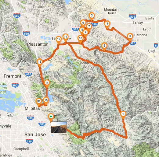
Despite how long the route takes in time, both loops only add up to 135 miles, which should indicate how tight the roads are. Much of the route is near-endless, twisty switchbacks, perfect for a supermoto, middleweight sport-standard or cruiser. But if you are interested more in views and empty roads than dragging hard parts in the corners, then any type of bike is perfectly suited; just make sure you have 75 miles range while negotiating long stretches of 2nd and 3rd gear corners.
The Outbound Leg
Leaving San Jose by highway 130-E (Mt. Hamilton rd.) allows you to escape population almost immediately, changing from city to ranch houses before they, too grow sparse. Watch out for blind driveways and crossroads until you’re far enough out. From there the road is still without a shoulder, so mind the double-yellow because import tuner cars and pickups pulling horse trailers will be using all the road coming the other way. Despite that, my biggest close call on this stretch came while rounding a bend and finding a rafter of turkeys (yes, a rafter, look it up) blocking both lanes. They scattered in time, but not without a large amount of front brake on my part. Still beats being stuck behind an RV if ya ask me.
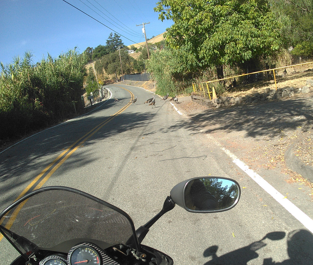 Surprises about on this route. Bumps, loose gravel, narrow roads, deer, and even
 Thanksgiving dinner turkeys should be expected.
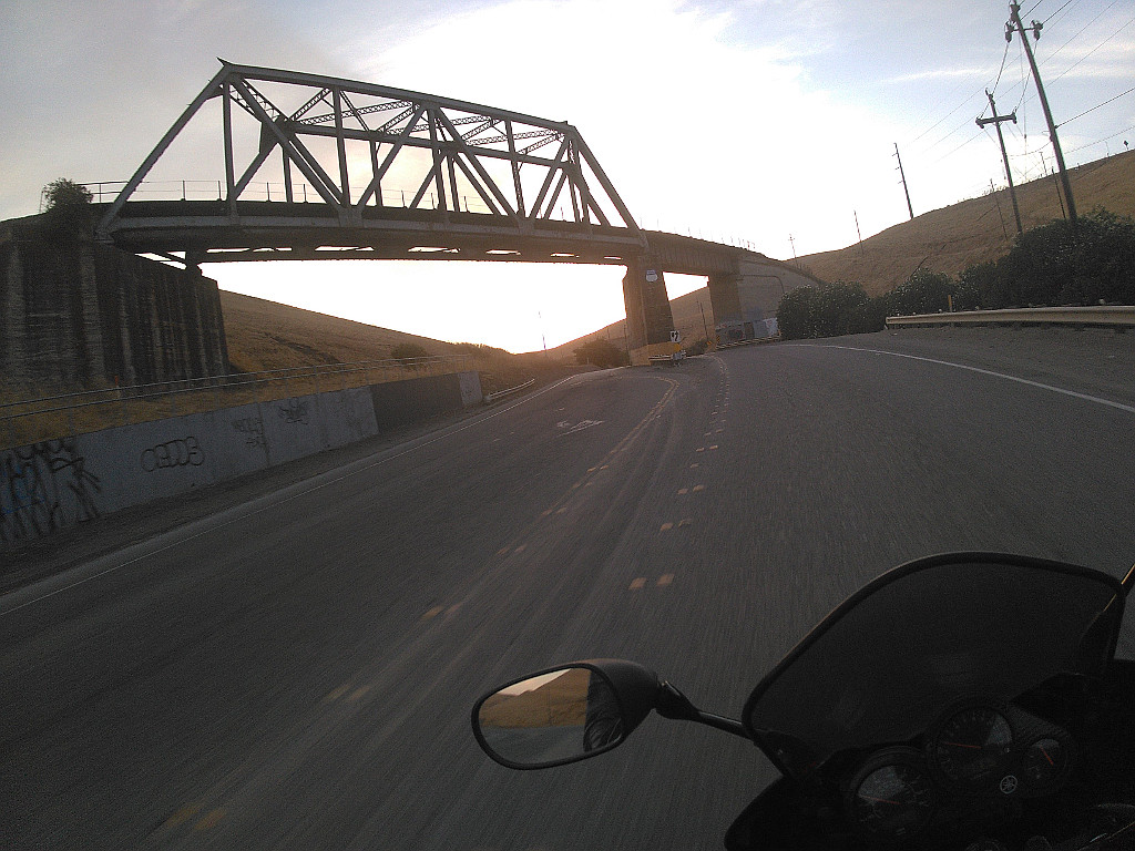
The next stop is Lick Observatory. Standing since 1888, the many domes and buildings are as much cultural landmark as they are a place for astronomical wonder. Since many of the staff sleep during the day, it’s wise to keep the revs down while approaching and leaving, since the highway cuts right through the middle of the compound. Parking is limited, so large groups should call ahead if they plan on stopping to check out the views. With so many turnouts before and after, I tend to find a more secluded spot for taking in the scenery. Still, it’s a great place to visit on its own.
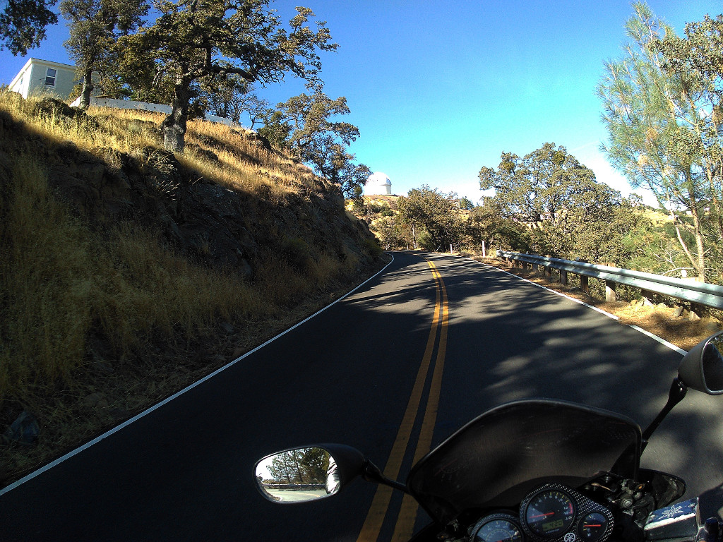 Lick Observatory is a landmark itself, with multiple telescopes, old buildings, and stunning views.
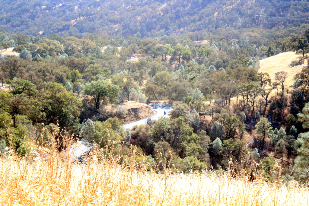
The descent down Copernicus Peak is quite steep and very twisty. Bring your A-game and watch for loose gravel at blind apexes. And make sure to check out the stunning views of the valley or carve up corners; never try to do both at the same time. Eventually Highway 130 turns right onto Del Puerto Canyon Rd.
Dual sport riders can continue that way and spend their day at Frank Raines OHV Park, but staying on hwy 130 will eventually take you out to Interstate 5. A better option for pavement-dwellers is to make a pit-stop at The Junction (if it’s open; it is undergoing management changes as of this writing), a great spot for burgers n’ beer or coffee and one of the many books off the shelf.
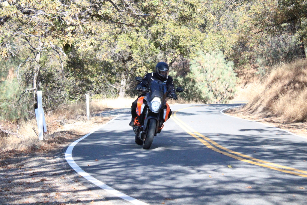 The descent from Copernicus Peak features many steep, 1st gear switchbacks, along with more flowing parts such as this. Quite the challenge.
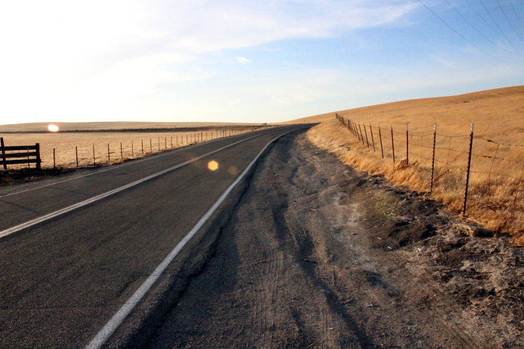
Leaving hwy 130 at this junction means continuing north on Mines Rd., which gains and loses its double yellow centerline several times. Although very lightly trafficked, don’t let brain-fade tell you this is a one-way road; oncoming traffic can be anything from another motorcycle to a 3-axle dump truck. This leg is much better for views anyway, passing through valleys of live oak and acacia, horse barns and ranch houses, until the country opens up before finally depositing you in the quaint farms and vineyards on the edge of Livermore.
The Second Loop
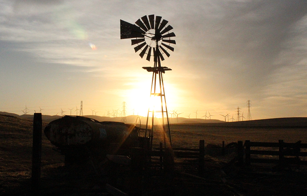
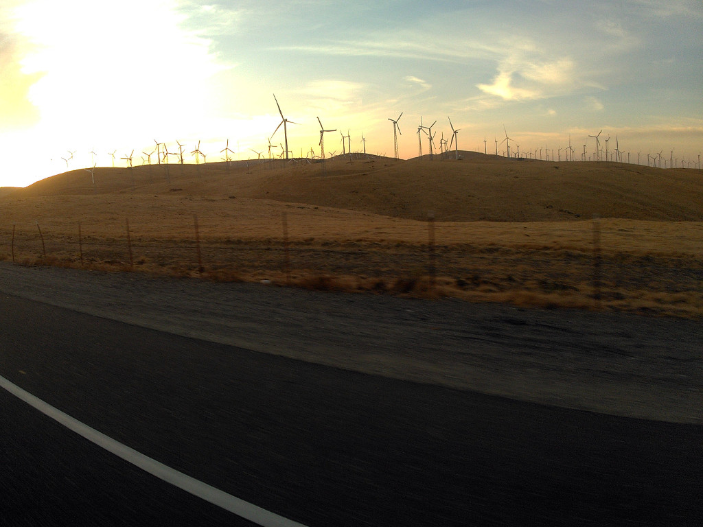
Once Mines Rd. dead ends, the options open up. People needing a short loop can begin the return journey (covered in the next section). Those looking for something to do can find half a dozen wineries to explore. Those looking for more roads should now turn right onto Tesla Rd. Take note: this is a great time to check the fuel gauge, no matter what your plans.Tesla Rd. winds through the steep hills of Corral Hollow, where the Carnegie State Vehicular Recreation Area lies. Dual sporters and adv riders may choose to explore the park’s many trails and multiple MX tracks, but the rest of us will want to continue onto I-5. Don’t worry, you are only heading north to the next exit… about 5.4 miles. Exit 67 is marked Mountain House Pkwy, but you’ll be turning left onto Patterson Pass Rd. After only 1.5 miles you can choose to stay on Patterson Pass Rd. or make a right onto Midway Rd. The junction is easy to spot since it’s right where a substation for the wind-farm is; the lines and transformers are easily visible as you approach. For a little new vs. old feel, I like to head up Midway Rd. to see the abandoned windmill. Left to rot along with the hulk of an old water truck and some derelict fencing, the old mill will slowly turn with an eerie screech-and-groan whenever the wind picks up. Its bullet-riddled vane will still pivot the old rotor into the wind, while dozens of modern wind turbines silently whirl in the distance, generating power for the city.
Once you’re filled up on solitude and reflection, continue north until Midway Rd. dead ends into Grant Line Rd. A quarter-mile to the right is the Mountain House Bar & Grill. For those interested in live bands and their large outdoor area, it can be an excellent pit stop. If you stay too long the interstate is right there for you to jet home, but our loop is supposed to turn left here, snaking west through Altamont Pass (keep right at the fork onto Altamont Pass Rd.), crossing through rows of wind turbines and under the railroad tracks until turning back toward the interstate.
Carrol Rd. is a left turn that is easy to miss, but there are plenty of skid marks from trucks and a sign pointing you toward I-580. Turn here but instead of getting on the freeway, fly right over it, letting it become Flynn Rd. on the other side. There are several surprise hairpins on this stretch (along with beautiful views), so pay attention. Flynn Rd. ends at Patterson Pass Rd., but instead of turning right and heading into town, go left for one mile until you see Cross Rd.
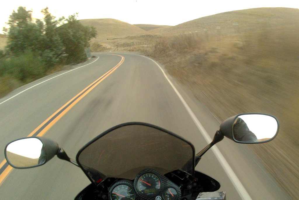 Flynn Rd. has some flowing sections punctuated by sudden, poorly marked hairpins and rough patches. Enjoy the view but pay attention.
Whether you decide to do the windmill version of the loop or just cut across Patterson Pass Rd., this turn onto Cross Rd. is where you’ll turn south, toward the center of the figure-8. One of my favorite parts of this loop is the ability to pick which mountain pass I want to do (Altamont or Patterson) based on how I feel at the moment.
The Ride Back
Those riding the single loop can turn left onto Tesla Rd. Those coming down Cross Rd. from the 2nd loop will turn right onto Tesla Rd. Either way, you are now heading west and toward town. The city of Livermore isn’t my idea of a good ride, so I recommend skirting the edge of town by turning left onto Concannon Blvd., then left on Holmes St. to hop on Highway 84.
Turn left onto hwy 84 (west) and meet up with I-680W in Sunol. Lately I have used I-680 as the end of the ride, but this will change when Calaveras Rd. reopens. Heavy rains in February washed out the roadbed, buckling the asphalt. Scheduled to open September 1, 2017, the road was still fenced off near the Calaveras Reservoir when I last took this loop on September 28th.
For those who know the road is open and want to take it, pay close attention as you begin to transition onto the I-680-S. An exit for hwy 84/ Dumbarton Rd. appears on the transition ramp. Take it down to the bottom and turn left, passing under the freeway. This becomes Calaveras Rd., gently wandering south until entering the Sunol Regional Wilderness, becoming twistier, then narrowing and shedding its double-yellow centerline. There can be a lot of truck traffic due to a quarry and many maintenance projects on the dam and hiking trails; this is another area that is best ridden with caution instead of exuberance.
Calaveras Rd. takes you back into San Jose (Milpitas, technically), where you have literally dozens of options as to where to finish off your ride. Restaurants range from chains to Mexican to fast food, all the way to sushi and Indian or Vietnamese. If you normally end rides in this area, be sure to share your favorite spot in the comments. And if you know of any other stops along the way that are deserving of a mention, be sure to leave those in the comments, too.
Grassland, forest, mountains, and multiple places to stop make this highly customizable loop in the East Bay one of my go-to routes.
Although this route is close to one of the most populous areas in California, it features some surprisingly empty roads and stunning natural view. And despite its seemingly short distance, the ride can take more than an afternoon. If you choose to stop at any of the off-road parks, wineries, wilderness areas, or the observatory, this easily becomes a day trip.